Metal Detecting Research and Exploration - A Complete Guide, page 22
Understanding Topographic Maps
3) TOPOGRAPHIC MAP SYMBOLS, SIGNS and LEGENDS
Topographic maps use a few dozens of symbols to represent both natural and man-made features existing on the ground.
The topographic map symbols can be of three types: points, lines, and polygons. Point symbols are used to depict features like bridges and buildings. Lines are used to graphically illustrate features that are linear (roads, railways, rivers, etc.). Polygons are used to depict narrow, elongated areas and features like drainage patterns, strongly contrasting soil landscapes, small islands, etc.
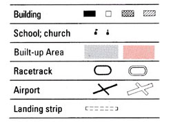
Place names and features are shown in a color corresponding to the type of feature. Many features are identified by labels, such as "Landing Strip" or "Golf Course."
Some topographic maps may use different symbols to depict the same object. This occurs because the symbols used are graphically refined over time. The map symbols are usually explained in the margin of the map, or on a separately published characteristic sheet. Following are a few compilations of topographic map symbols and their meanings:
• Modern US Topographic Map Symbols - This compilation includes symbols used on USGS 7.5-Minute Series Maps of scales 1:24,000 and 1:25,000 (metric) and the 15-minute topographic quadrangles at a scale of 1:63,360 (printed for the state of Alaska only). If you are not familiar with some features represented by topographic symbols, please visit the "Australian Topographic Map Symbols" photo gallery which includes explanations of all topographic features in each category.
• Historic USGS Topographic Map Symbols - This compilation includes symbols used on the USGS 15-minute series drawn at a scale 1:62,500 - First Generation topographic sheets, first printed in the 1890s, and USGS 7.5-minute topographic quadrangle map series drawn at a scale 1:31,680. The styles of the symbols have changed dramatically since the end of the 19th century.
• Modern Soviet Topographic Map Symbols - As a world superpower, the Soviet military initiated an unprecedented worldwide mapping effort to cover the entire globe in the 1970s. This global mapping project ceased only at the point of collapse of the USSR in the 1990s. Soviet military topographic maps of large scales still represent the best accessible coverage for many countries and those parts of the world where no better locally produced mapping is available.
The Soviet standards for map symbolization were established in the 1950s and incorporate more features than any other mapping in the world. This compilation includes map symbols used on the maps of scales between 1:25,000 to 1:1,000,000 defined as "topographic" maps by the Soviet military.
Soviet Print Codes
All Soviet topo maps have a print code in bottom right hand corner, which comprises the following: series code, job number, month and year of printing, and factory code. For example, the print code B 36/9 VIII-79 Cp means: the 1:50,000 topographic map was printed in August of 1979 in Sverdlovsk. Below is a table of Soviet print codes.
SERIES CODES:
Series codes:
- А - 1:10,000 topo
- Б - 1:25,000 topo
- B - 1:50,000 topo
- Г - 1:100,000 topo
- Д - 1:200,000 topo
- E - 1:500,000 topo
- Ж - 1:1,000,000 topo
- И - 1:10,000 and 1:25,000 city plans
Factory codes:
- Д - Dunayev (Moscow)
- K - Kiev
- Л - Leningrad (now St Petersburg)
- Cp - Sverdlovsk (now Ekaterinburg)
- Cpт - Saratov
- Т - Tashkent
- Тб - Tblisi
• Australian Topographic Symbols - This compilation of modern topographic symbols also includes explanations of all features in each category.