Metal Detecting Research and Exploration - A Complete Guide, page 15
Map Research for Locating Hunt Sites in Europe
IMPORTANT SPECIFICS
(CONTINUED from Page 14)
Land Registers or Land Books were also issued in other European countries during the Early Modern period. From the 1530's onwards the Land Books were updated yearly and thus became a standard feature for the accounts of tax collectors.
A Page Fragment of Swedish Land Register Book, ca. 1600s
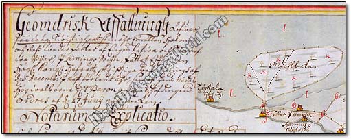
In the early 17th century, Sweden took a leading position among other Scandinavian countries in surveying and mapping. In 1640s Swedish National Land Survey began issuing two types of large-scaled maps: geometric and geographical.
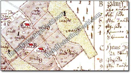
Geometric surveying was used for measuring the villages and homesteads and produced maps of large scales (described on page 25), usually 1:4,000. The Swedish cartographers invented the basics for thematic and topographic large-scale mapping. The geometric maps took up only the cultivated land - fields and meadows, not forest. The maps were put together in books called geometriska jordeböcker - Geometrical Land Books (swe.), Erdbuch or Landbuch - Land Books (German).
A Fragment of Swedish Geometric Map, circa 1707, Showing Homesteads
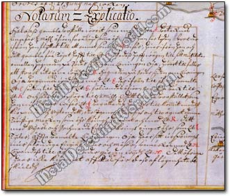
These maps generally show buildings, infields with their arable and meadow lands, fences and certain forms of vegetation. Just like in the case of the "wasted grounds" described in the Economical Notes to a Map, a similar systematic explanation/description - Notarum Explicatio, is appended to the map and includes a number of homesteads in the village, the values of individual parcels of land, and land-tenure information.
Notarum Explicatio with Descriptions of Homesteads