Relic Hunting In Karelia
Old Mill Site Discovery
A few years back, my treasure hunting buddies and I made a couple of metal detecting trips to the Karelian Isthmus. On our first outing, we tried to locate the ruins of a medieval Russian fortification. During the second trip, we metal detected at the sites of Finnish homesteads marked by the large stone foundations and root cellars scattered in dense forest. Both outings were unsuccessful.
Detecting on Karelian Isthmus Back in 2004
Through the similar testimonies of many other treasure hunters, I learned about the impossibility of locating a productive metal detecting site in this region, and that the Karelian Isthmus had become an unpopular spot for the members of the St. Petersburg's metal detecting community.
Knowing a little about Karelia's history back then, I too believed in this "myth": the region was not productive in terms of good metal detecting finds, neither coins nor relics, due to its rough and rocky terrain, impenetrable woods, lack of cultivable space - all these natural obstacles would prevent any medieval community from growing and becoming wealthy back in the early days.
As I began digging into the history of Karelian Isthmus, particularly Priozersk area, my doubts about the myth were growing. I could not think that there were no good treasure hunting sites in the area around the city which had been the outpost of either Russia or Sweden on the Trade Route for 600 years. From the times of Vikings to the heyday of Russian Empire, Priozersk witnessed numerous historical events, both good and bad - from the active trade between North and Byzantine Empire to the countless devastating fires and military conflicts.
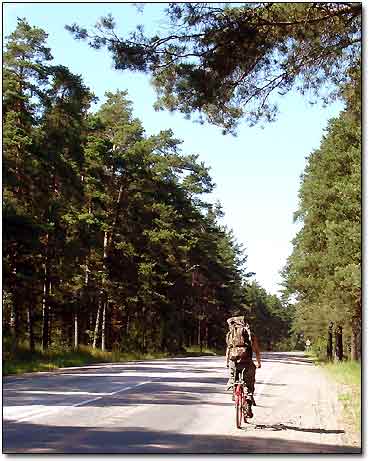
Now, as I wound up in Priozersk for a few days in July, I had the only chance to bust the myth. Limited with time and resources - no computer to do the research and no reliable transportation to get to the remote locations, I narrowed my search to the area within 15 - 20 kilometers of the city - that would allow me to use a bicycle to get to places.
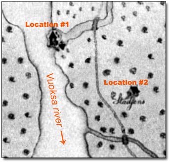
Right away, I visited both the local library and the Korela fortress museum. After looking through the old books for hours, I finally found what I was looking for - a 1651 Swedish map that depicted all villages and monasteries in the surrounding area. With modern topographical maps at hand, I examined the Swedish map for potential metal detecting sites that were void of modern infrastructure. Two locations attracted my attention: the first one was a site of the medieval monastery situated on a small island (now could be just a peninsula covered with forest) at the mouth of the Vuoksi river's tributary, the second location was the site of a village, now just a field with a few summer houses on its boundaries.
Fragment of Swedish Map from 1651
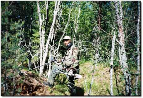
I decided to start with the most challenging spot - location #1. The island would not be separated from the mainland by the wide stream as it was a dry summer season, plus, the water level of Vuoksi river was seven feet lower now than in 1651. The question was whether I could get onto the island from the north or south. If any attempt to get there on foot failed, my last resort would be to use a boat.
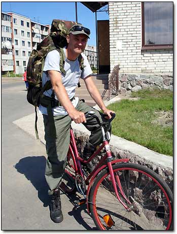
This time, my only choice of "wheels" was a bicycle. In my treasure hunting experience, I had already pedaled to the metal detecting sites before. The only difference now was that I had to do it in the middle of hot summer. Oh well, anything for the spirit of adventure!
No Car This Time