Rethinking the Concept of Pinpointing the "Hot Spot"
While cooling off, I began thinking about a general method of finding a "hot" spot - a site of the medieval settlement, in the Kievan region. (Not to be confused with a "hot" spot which can be located, for example, at the cellar hole site somewhere in Upstate New York. In that case, it is a small spot where most of the coins were lost.)
While treasure hunting in Ukraine, I realized that there would not be just one set of rules for pinpointing a "hot" spot, because many different cultures existed in the region. Each culture had its special features or characteristics in terms of the way of life, warfare, farming, production of goods and trade as well as the level of technological development. And these characteristics changed dramatically from one culture to another throughout the history of the region.
Considering that at least a dozen of various cultures existed around the Dnieper river during the 2,500 years period, it would take me a long while to complete my project. Because of my limited knowledge of all cultures and their characteristics, I decided to narrow my focus to only two cultures: Chernyakhov (2nd-5th centuries) and Kievan Rus (9th-11th centuries), the relics of these cultures would be usually found at one site. I would also focus on only a few cultural characteristics: type of terrain relief suitable for a settlement, type of a settlement and availability of rich soils.
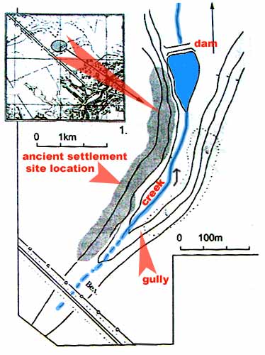
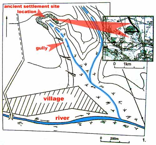
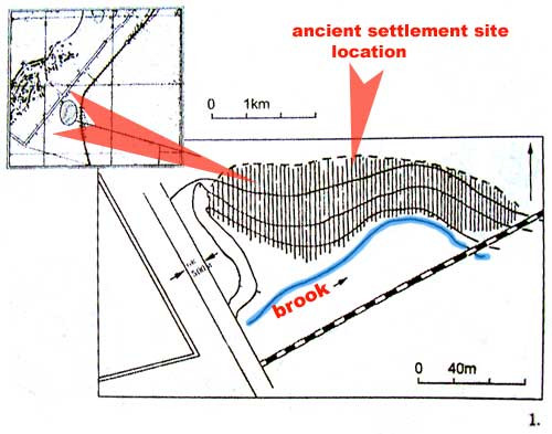
From the archaeological books I had read so far, I knew that the early medieval settlements of the Chernyakhov culture were unprotected and built 1) near water sources - brooks, creeks, rivers and lakes, 2) on the slopes of gullies and 3) near rich agricultural soils. The drawings of the archaeological locations illustrate that.
Finding many fragments of pottery would be also helpful in locating an ancient settlement. Iron signals would be scarce as the iron was not produced in large quantities in those times. More likely one would find numerous bronze or copper relics at such spot.
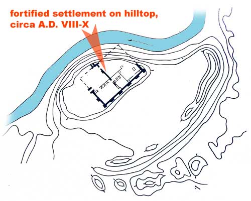
The largest settlements of Kievan Rus were fortified and called "hill-forts" (they began appearing from the fifth century onward) or "gorodische" as they were built on top of the hills or plateaus. Large earthworks on the high banks and promontories of rivers and lakes adjoining the sizeable villages or "towns" were heavily fortified with the use of timber constructions and tamped clay for building of ramparts. In some earthworks the area encompassed by such fortifications was from one-half to one hectare (about 1¼ to 2½ acres).
Hill-Fort, circa AD VIII - IX
So, the best way of determining a location of the early medieval "hot" spot would be really the usual one: research, research and research. If that is not available, one has to learn all visual cultural characteristics and look for their signs while doing the footwork.
As for pinpointing the later medieval settlements, the method would probably be the same as for locating the site of the 18th - 19th century village: by searching in All Metal mode for a spot with high concentration of the iron signals, china shards and brick or clay-stone fragments. In some cases, the cultural layers would be positioned on top of one another in the soil or mixed up if the site is located in the frequently plowed field.
Thinking back about my trip with Bob (the story above), I realized that we were looking for a "gorodische" on top of the plateau while we were supposed to be looking for a settlement at the bottom of a gully. So it is important to know exactly what one would be looking for.
In the situation similar to the one in Upstate New York, the most advanced and effective way of pinpointing a "hot" spot at the site is to see the surroundings as they would appear to the medieval person's eyes... Well, that would be a different story (read below).
While I was resting and theorizing in the shade, Dima and Sergei started the BMW engine and drove by on the way to the "hot" spot. I could not wait to see what that site looked like in daylight. So I crawled out of the shelter into the "inferno" and started walking through the field towards the windbreaker - a forest boundary between the fields, behind which our potential site was located.
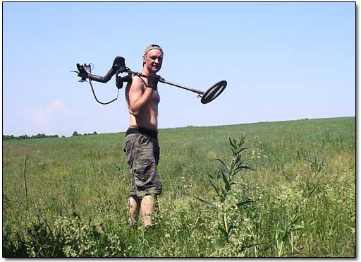
A Huge Field, 100°F