Metal Detecting WW2 German and Russian Military Relics in Estonia, page 1
Digging WW2 Artifacts Not By Choice
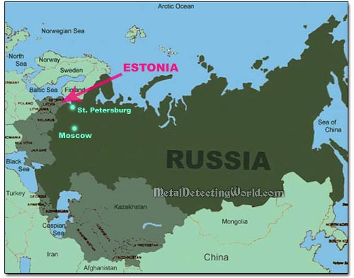
General Map of Russia and Surrounding States
Estonia is the northernmost of the three Baltic States in Eastern Europe. After having been conquered by the Danes, the Livonian Knights, the Teutonic Knights of Germany, the Swedes, the Poles and Russia, Estonia declared itself an independent republic on February 24, 1918 but was not freed until February 1919.
Shortly after the start of World War II, it was again occupied by Russia and incorporated as the 15th state of the U.S.S.R. Germany occupied the tiny state from 1941 to 1944, after which it was retaken by the Soviet Union. Estonia gained its independence from Russia in 1992. In may of 2004, Estonia became a member of the European Union (EU).
Back in 1992 when Estonia broke away from Russia, thousands of native Russians who had resided in Estonia became citizens of a different country almost overnight. My mother was among them. She lives in the city of Sillamäe located in the North-Eastern Estonia and on the shore of the Baltic Sea. Fortunately, the entire North-East of Estonia is populated with native Russians so my mom does not have to struggle with Estonian language.
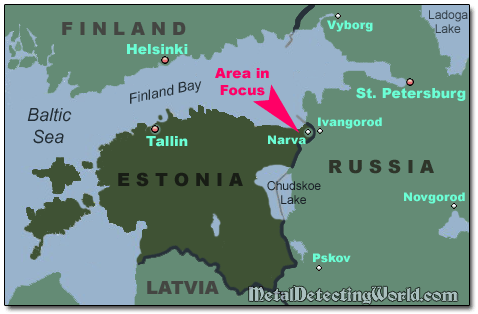
The easiest way to get to the city of Sillamäe from St. Petersburg, Russia, is to take the highway that leads to Tallinn, the capital of Estonia, and follows a medieval route. One of the interesting historic locations on that route is the crossing point of the Narva River, now the Russian-Estonian border.
By the Middle Ages, the historic border had been already running there along the banks of rapid river. It swiftly flows its waters out the Lake Peipsi into Baltic Sea and divides the two civilizations, the Catholic European North and Orthodox Slavonic East. Opposite to each other, there are two old cities, Ivangorod and Narva, situated on the riverbanks.
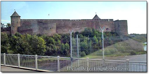
In close vicinity to each other (at distance of an arrow flight or that of a musket shot), two giants of stone, the Castle of Order of Germanic Knights and the Russian fortress of Ivangorod, tower two opposite banks. The fortress on the Russian side was built in 1492 during the reign of Ivan III as a counter to the Livonian fortress city.
View of Ivangorod Fortress from the Bridge over Narva River
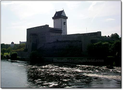
The Narva Castle named Pikk Hermann (i.e. Tall Herman) on the Estonian side was built by the Danes in 1270. The fortress acquired its finished look in the beginning of the XV century during the course of its military and architectural rivalry with Russia's Ivangorod fortress.
Pikk Hermann Castle in Narva
In the XVII century, Estonia belonged to Sweden who practically ruled over the whole Baltic Sea. The Russian Czar Peter I (Peter the Great) wanted to get possession of Ingermanland, or Ingria, and part of Karelia which used to be parts of Russia before being taken by Swedes in the early 1600s. In 1700, Russia officially declared war to Sweden, the focus was set on the Narva castle.
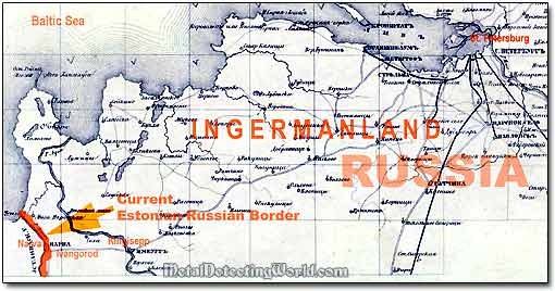
A Fragment of 1868 General Map of Ingermanland
But right at the beginning of the war, the forces of Czar Peter the Great were defeated by the army of the Swedish King Carl XII during the Battle of Narva in 1700. In the summer of 1704, the Russian forces stormed Narva Fortress again and captured it from the Swedes.
While learning more about the history of Estonia, I constantly thought of possible results of treasure hunting there. Finally, I was ready to do it.
