Part I - Metal Detecting at the Swedish Tavern Site, page 5
Novgorodian Ingermanland (Ingria) and Its Fortified Centers in Medieval Times
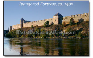
In 1492, to fend off the Livonian Knights, the Russians built the fortress Ivangorod opposite to the Narva Castle across the Narova River. The original castle was constructed in one summer and named after the Moscovian Grand Prince Ivan III. During his reign, Moscow completed the incorporation of Russian lands including the Novgorodian republic.
Back in 1478, Ivan III's army captured the rebellious city of Novgorod, massacred its population and destroyed the popular assembly (parliament), the library and archives. At that point, the history of the Republic of Novgorod ended. As Muscovy grew in strength, the borders of the Russian State were reinforced by erecting new fortresses and reconstructing the old ones. Ivangorod citadel was one of these new defensive complexes.
In 1496 the Swedes took the fortress. However, later in the year, Ivangorod was won back by three thousand Muscovite troops arrived to take the place of the garrison which had been wiped out during the siege. For almost 10 years, the land around the castle was in constant warfare. The fortress changed hands repeatedly. The castle was reconstructed and fortified many times, becoming one of the strongest defensive structures in the 16th century. In 1704, following the capture of Narva by the troops led by Peter the Great, the Swedish garrison of Ivangorod surrendered. Russia yet again regained control over the fortress.
As a counter to the Teutonic Knights' Narva Castle, Ivangorod is still impressive in size. The square citadel measuring 1,600 sq ft, with walls up to 16m high, was sufficiently powerful to repel enemy charges and defend the nearby settlements. And today the Narva/Ivangorod border-crossing point is the only place in the world so clearly exhibiting the irreconcilability and rivalry between the Western and Eastern Christianity.
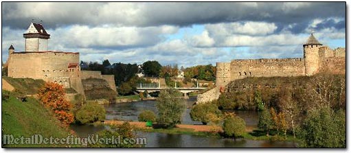
Narva Herman Castle (on the left) and Ivangorod Fortress (on the right) Still Guard Each Other
Another historical place where now the modern city of Kingisepp is situated, only 14 miles away from Ivangorod to the east, deserves a special introduction. The Kingisepp region is the area on which my detecting buddy and I have been recently concentrating all our treasure hunting efforts.
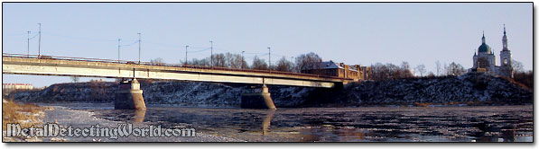
A Bridge Over Luga River into the City of Kingisepp
Back in 1384, the Novgorodians built here the legendary Yam (Yamgorod, Jama, Yamburg) fortress to protect the trading route on the Luga river, which connected Novgorod to the Baltic Sea, against Swedes and Livonian knights frequently attacking from neighboring Livonia. The citadel withstood sieges by the Teutonic Knights in 1395 and during the 1444-1448 war and by the Swedes during the Swedish-Novgorodian Wars, and the town became the most important economic center of the Vodskaya pyatina (one of five districts of Novgorod Republic).
For almost 200 years the Yam fortress remained unassailable, and only in 1581 it was taken by the Swedes for the first time. The Russians seized it in 1595. In 1611-1612 it again passed to the Swedes, who kept the name which in Swedish orthography became Jama.
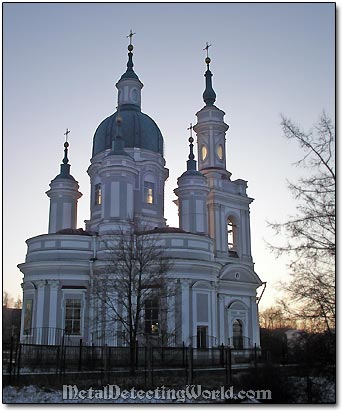
In 1703, the Russians took it back in the course of the Great Northern War, and the citadel was renamed Jamburg (a German version of the name). The fortress lost its strategic importance by the mid-18th century, and in 1761 it was demolished to provide stones for building the St. Catherine Cathedral nearby.
St. Catherine Cathedral, ca. 1764, in Kingisepp
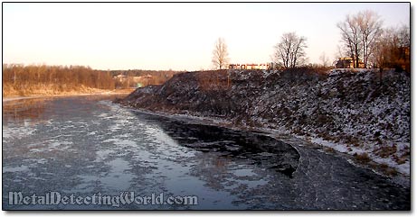
The citadel had completely disappeared by 1816. Now only the high ramparts and bastion foundations, partially visible from the riverside, remind us of it. But if to imagine the 240-meter long by 170-meter wide stone citadel at this location, it would be a spectacular view!..
...Every time my treasure hunting buddy and I were returning from the hunt, driving across the bridge over the Luga river and entering the city of Kingisepp, I was looking at the high riverbank on top of which the fortress used to stand and I imagined the mind-boggling view with the medieval fortress as if it was still standing there!
Yam Fortress Bastions Once Stood on This High Riverbank
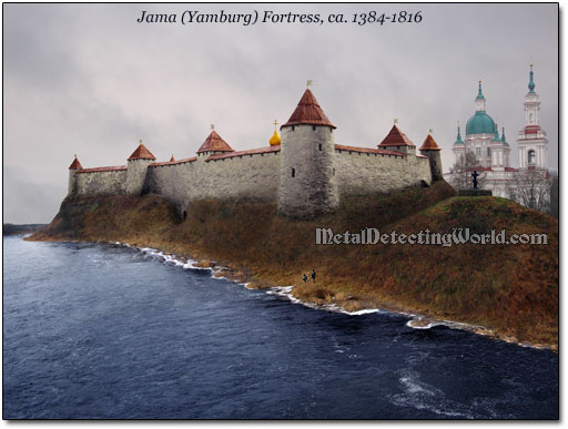
After studying the old Swedish plans and sketches of Jama citadel and the aerial photos of this spot, I painstakingly created the most realistic picture of the fortress - what it looked like exactly at this spot a few centuries back! (Viva el Photoshop!)
Yamburg fortress and the St. Catherine Cathedral in the background can be seen together only in one's imagination.
By the 17th century, after centuries of warfare and devastation, Ingermanland had lost a substantial part of its population as many villages and towns had been ravaged by a train of wars, some settlements never recovered. Before running away from the upcoming military plunder, the inhabitants used to bury their treasures in hopes to retrieve them upon their return. It is hard to imagine that many people returned to their villages at any moment of constant military havoc that lasted for five centuries, and the end of it was not to come for another hundred years!
Now you can see why I consider the western Ingermanland the best area for cache hunting. Since I unearthed my first hoard of the medieval hammered coins a few years ago, this land has proved to be the most "fruitful" many times.